Property Record
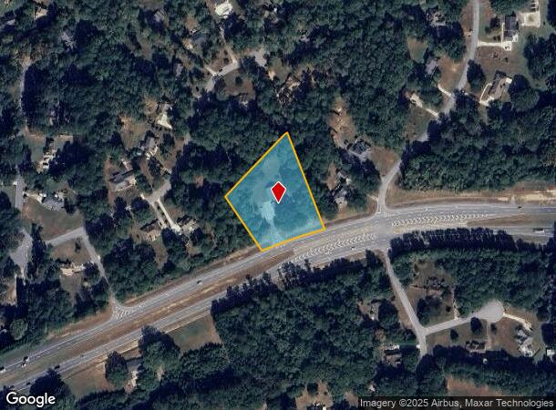
4308 Highway 34 E, Sharpsburg, GA 30277

NEARBY LISTINGS FOR SALE OR LEASE
Property Detail
4308 Highway 34 E
Atlanta-Sandy Springs-Roswell, GA
Shoal Creek Forest
133A-001
BLDG/1.386AC TR 1 SHOAL CRK PL
Hospitalprivate
Coweta
X
Georgia
13077C0170D
1
0
1.39 AC
2025
Coweta County
170404
Atlanta
4,544 SF
DEMOGRAPHICS near 4308 Highway 34 E
1 Mile
3 Mile
5 Mile
2024 Total Population
2,150
21,776
64,578
2029 Population
2,395
23,783
70,349
Pop Growth 2024-2029
+ 11.40%
+ 9.22%
+ 8.94%
Average Age
43
41
42
2024 Total Households
778
7,764
23,704
HH Growth 2024-2029
+ 11.44%
+ 9.25%
+ 8.92%
Median Household Inc
$97,800
$113,200
$101,895
Avg Household Size
2.70
2.80
2.70
2024 Avg HH Vehicles
3.00
2.00
2.00
Median Home Value
$290,859
$337,794
$332,005
Median Year Built
1993
1996
1995
Nearby Places
Map Layers
Map Styles
 Street
 Aerial
- Restaurants
- Banks
- Shops
- Fitness
- Groceries
PUBLIC TRANSPORTATION
AIRPORT
Hartsfield - Jackson Atlanta International
DRIVE
WALK
Distance
Hartsfield - Jackson Atlanta International
38 min
29.0 mi
Freight Ports
Georgia Ports - Savannah
DRIVE
WALK
Distance
Georgia Ports - Savannah
292 min
249.6 mi
Nearby Properties
Address
Land Use
TOTAL SIZE
Lot Size
Zoning
Address
Land Use
TOTAL SIZE
Lot Size
Zoning
171,535 SF
27.60 AC
C GC
Address
Land Use
TOTAL SIZE
Lot Size
Zoning
166,866 SF
85.16 AC
R1
Address
Land Use
TOTAL SIZE
Lot Size
Zoning
156,113 SF
25.37 AC
001
Address
Land Use
TOTAL SIZE
Lot Size
Zoning
89,736 SF
11.56 AC
C GC
Address
Land Use
TOTAL SIZE
Lot Size
Zoning
202,691 SF
24.65 AC
C GC
Address
Land Use
TOTAL SIZE
Lot Size
Zoning
71,888 SF
23.48 AC
R1
Address
Land Use
TOTAL SIZE
Lot Size
Zoning
72,703 SF
8 AC
C GC
Address
Land Use
TOTAL SIZE
Lot Size
Zoning
47,598 SF
4.29 AC
C
Address
Land Use
TOTAL SIZE
Lot Size
Zoning
153,191 SF
20.95 AC
R1
Address
Land Use
TOTAL SIZE
Lot Size
Zoning
121,290 SF
11.74 AC
R1
Address
Land Use
TOTAL SIZE
Lot Size
Zoning
59,250 SF
8.77 AC
R1
Address
Land Use
TOTAL SIZE
Lot Size
Zoning
86,761 SF
6.35 AC
C LUC
Address
Land Use
TOTAL SIZE
Lot Size
Zoning
112,650 SF
5.70 AC
002
Address
Land Use
TOTAL SIZE
Lot Size
Zoning
137,702 SF
17.39 AC
R1
Address
Land Use
TOTAL SIZE
Lot Size
Zoning
52,001 SF
4.01 AC
C GC
Address
Land Use
TOTAL SIZE
Lot Size
Zoning
90,474 SF
12.56 AC
C
Address
Land Use
TOTAL SIZE
Lot Size
Zoning
47,285 SF
11.80 AC
C 0I
Address
Land Use
TOTAL SIZE
Lot Size
Zoning
28,753 SF
4.83 AC
R1
Address
Land Use
TOTAL SIZE
Lot Size
Zoning
43,812 SF
10 AC
C GR10
Address
Land Use
TOTAL SIZE
Lot Size
Zoning
103,594 SF
18.83 AC
R1
Address
Land Use
TOTAL SIZE
Lot Size
Zoning
47,540 SF
6.33 AC
R1
Address
Land Use
TOTAL SIZE
Lot Size
Zoning
31,490 SF
2.48 AC
C GC
Address
Land Use
TOTAL SIZE
Lot Size
Zoning
28,560 SF
10.91 AC
R1
Address
Land Use
TOTAL SIZE
Lot Size
Zoning
80,564 SF
16.23 AC
R1
Address
Land Use
TOTAL SIZE
Lot Size
Zoning
31,794 SF
2.65 AC
R1
Address
Land Use
TOTAL SIZE
Lot Size
Zoning
96,728 SF
12.50 AC
C GC
Address
Land Use
TOTAL SIZE
Lot Size
Zoning
98,838 SF
8.18 AC
R1
Address
Land Use
TOTAL SIZE
Lot Size
Zoning
67,604 SF
29.71 AC
R1
Address
Land Use
TOTAL SIZE
Lot Size
Zoning
17,903 SF
3.63 AC
C GC
Address
Land Use
TOTAL SIZE
Lot Size
Zoning
41,355 SF
25.21 AC
R1
The World's #1 Commercial Real Estate Marketplace
Connect with us
© 2025 CoStar Group
The information above has been obtained from sources believed reliable. While we do not doubt its accuracy we have not verified it and make no guarantee, warranty or representation about it. It is your responsibility to independently confirm its accuracy and completeness. Any projections, opinions, assumptions, or estimates used are for example only and do not represent the current or future performance of the property. The value of this transaction to you depends on tax and other factors which should be evaluated by your tax, financial, and legal advisors. You and your advisors should conduct a careful, independent investigation of the property to determine to your satisfaction the suitability of the property for your needs.